Adrian Tyler, a resident of Atlanta’s Oakland City, tagged us this summer in a tweet about catching a bus on Campbellton Road. Check out the video she made of a MARTA bus stop outside of Fort Mac. There’s no sidewalk, just a thin strip of weedy ground to stand on as cars whiz past, and no crosswalk in sight.
The 83 bus that serves this road is the second-most heavily used route in MARTA’s system. The fact that these terrible conditions for pedestrians exist alongside such a well-used set of bus stops is very troubling. It speaks volumes about the way Atlanta as a city values its transit users.
MARTA is in the planning process of converting this popular bus line either to either Bus Rapid Transit (BRT) or light rail. Check out their Campbellton Corridor page for details. A big question: will the city that’s neglected Campbellton bus riders for years be able to better support riders of BRT or light rail?
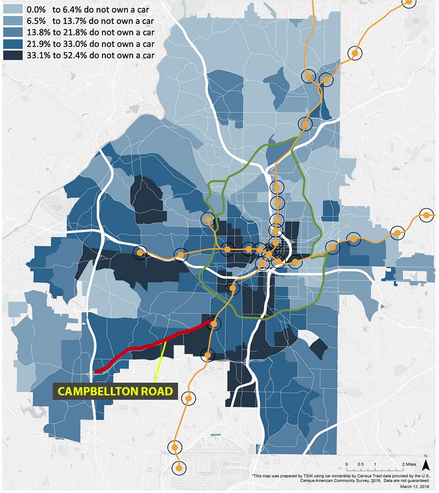
The purpose of this post is not to question the logic of putting a new rapid transit line on Campbellton. The stats on bus ridership already support expanded transit capacity. What I was to emphasize is how desperately the transit users in the corridor need better infrastructure, for multiple reasons. One of them being the relatively high percentage of residents who don’t own a car here.
In the map below, Campbellton Road (the portion of it being studied for rapid transit) is surrounded by districts where 21.9% to 52.4% of people have no car, based on 2016 Census data. We should have been serving these folks with improved walking infrastructure a long time ago.

A walking tour of Campbellton’s many problems
Adrian Tyler invited me and my wife on a guided tour of what pedestrians experience on this road. We met her at the Oakland City MARTA Station to begin our walk.
The first things I noticed: the patchy sidewalk coverage, and the long the distances between safe places to cross the road. It was also clear that many sections of the sidewalk, when they did appear, were not wide enough for ADA compliance due to the many utility poles in the way.
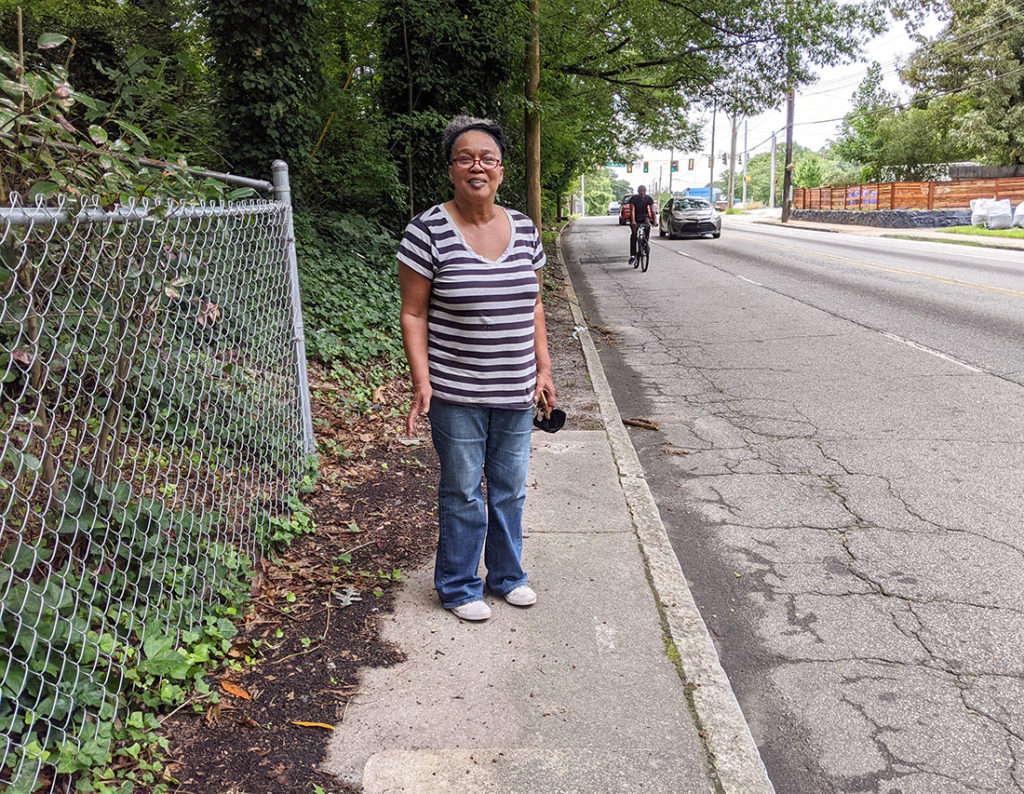
Here’s Adrian in one of the spots where the sidewalk ends — notice the cyclist behind her (one of several who passed us) with no bike lane.

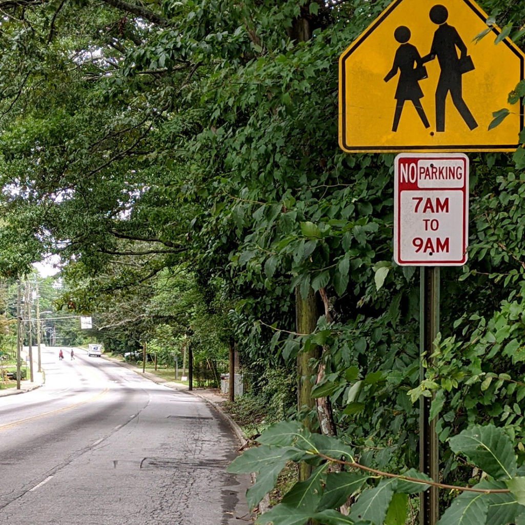
Here’s a photo of one of the long stretches of Campbellton without any safe place to cross the road, despite the presence of bus stops and homes.
In the distance, two people take their chances with crossing while motorists drive around a curve. I guess the yellow pedestrian sign is meant to serve as a substitute for actual safe conditions? It’s a poor one. Also, notice the utility poles in the middle of the skinny sidewalk. The whole time we experienced this environment I kept thinking: “How can these residents ever trust that the city will support rapid-transit riders well?”

As we made our way down Campbellton, Adrian would occasionally stop a local pedestrian to ask what they thought about the conditions. Their frustration with the road was apparent, as was the feeling that city leaders had failed them.
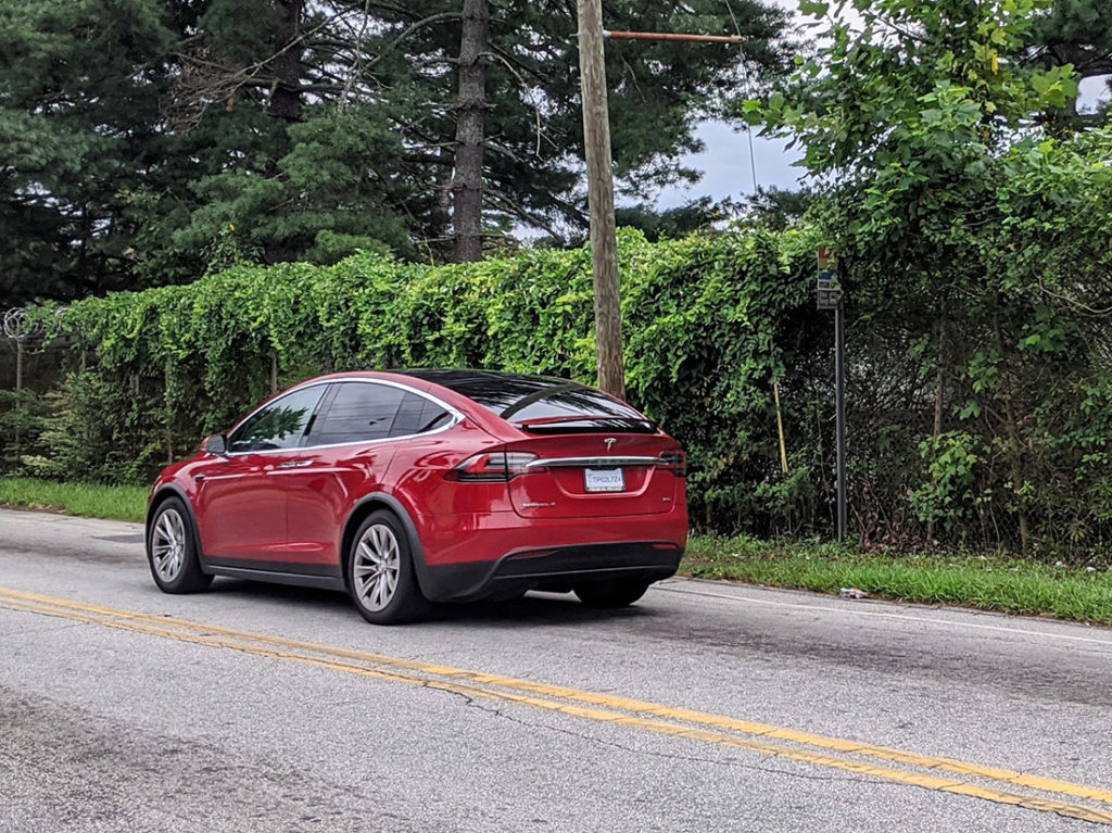
For this next photo, let’s play a game of “find the bus stop.” We saw multiple ones like this: no safe way to reach the stop on foot, and no dignified way to wait for a bus for sometimes long periods depending on whether it’s running on time. And it’s not even very visible from the street, thanks to the overgrowth.
Think about it. This is a bus stop on a street in our city, on the second most-heavily used bus route in a major U.S. transit system. And to top it off, beyond that fence in the Fort Mac property, which held so much promise for the neighborhood when it was shopped for redevelopment in 2014.

To be fair, the City of Atlanta is planning to make pedestrian improvements to a couple of sections of Campbellton Road. There’s a scheduled start of next year on the work. But the part of the road we toured and photographed is not included in the scope of that project, per a map on the Atlanta DOT website. I’m not sure why.
In closing, here’s a telling photo about the often-toxic relationship between Atlanta leaders and the most vulnerable road users. Adrian tells me that she and others have been publicly calling for safer infrastructure for pedestrians in Oakland City for many years. But elected officials have apparently been unresponsive. (Ironically, on our tour we passed the local voting precinct, which had no sidewalk). And yet politicians still want to use Campbellton as a place to hang their campaign signs — even on some of the most dangerous sections for walking.

This walk helped me understand why many locals cry foul when a major, costly investment is planned near them; they understandably think: “If someone’s going to spend money in our neighborhood, why can’t we first get the basic necessities we’ve been asking for all these years? Like sidewalks and crosswalks at bus stops?”
Yes, MARTA and the City of Atlanta are two separate entities. But both play equally important roles with ensuring safety and dignity for transit users. City leadership has not done enough to earn the trust of people in places like Oakland City, and city residents and voters — even ones who never use MARTA — need to care about this.
What can we do?
Regardless of what happens with rapid transit, all of Campbellton Road needs better conditions for pedestrians as quickly as we can provide them. It’s long overdue. The disconnected sections targeted by the currently-slated Atlanta DOT project aren’t enough.
Here are the City Councilmembers who’s districts cover sections of Campbellton:
Transit users on this road need whatever we can provide, by way of tactical urbanism fixes, that allow improved safety until long-term, comprehensive infrastructure is built. City Council and the Mayor’s office need to work together to get these fixes funded and implemented now. If you need ideas, just look at the Tactical Urbanism Guide that your own city created. We know what works to improve safety quickly. Now we need leaders to follow through.
